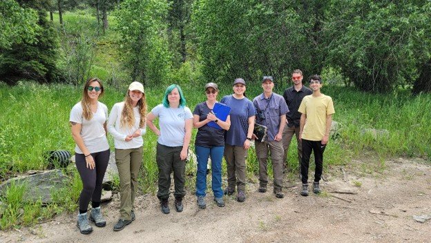
Big Thompson River – Buckhorn Creek Site Conservation Team
The Buckhorn Creek Site Conservation Team (SCT) seeks to collaborate with the local community on projects that improve riparian habitat quality and stream embankment integrity.
The area includes portions of the Buckhorn Creek Watershed below 7,600 feet in elevation and runs along Larimer County Road 44H down to Larimer County Road 27 into the Masonville area.
The Buckhorn Creek watershed is home to many native species that rely on the riparian habitats that exist along the creek. One of these species is the Preble’s meadow jumping mouse, whose populations have been negatively impacted from habitat loss across the Front Range of Colorado and into Wyoming. The preferred habitat for the mouse includes riparian corridors and meadows, both of which have been lost in the lower elevations of the species’ range.
Suitable habitats, however, do still occur in the higher elevations of the Buckhorn Creek watershed. These areas are mostly undeveloped and held privately or are within Public Lands Forest Service ownership. Over the past decade the area experienced several natural disasters, including the 2013 floods, the 2020 Cameron Peak Fire, and the subsequent post-fire flooding that impacted the watershed in 2021-23.
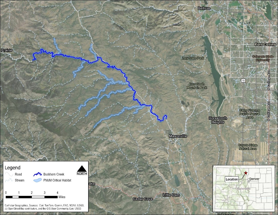
Map Figure: The Buckhorn Creek SCT study and project implementation area.
How is the health of the watershed??
In September of 2013, the entire Front Range of Colorado experienced heavy rainfall that caused major flooding in streams and rivers across the area. The Buckhorn Creek watershed was significantly impacted where the creek overfilled its banks and water and debris overwhelmed culvert crossings and damaged roads. Many of the culverts were corrugated steel pipes and were undersized for the 100-yr storm event.
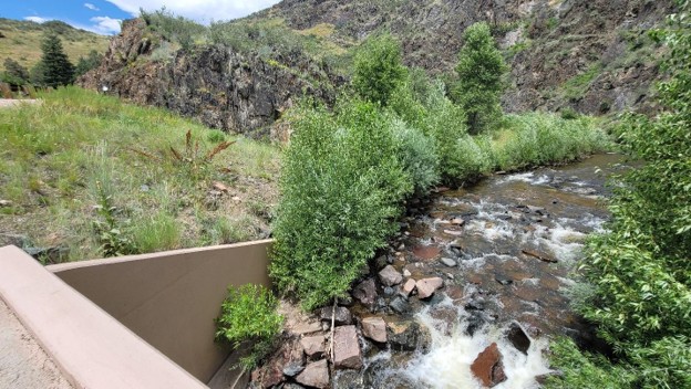
In response to the damage, Larimer County worked with FEMA to implement repairs that involved increasing the resiliency of the infrastructure within the watershed. The road was moved up and away from the creek and many culverts were upsized to withstand the higher flows associated flood events. The upsized culverts also improved the riparian habitats for fish and other animals because the steel pipes were replaced with concrete box culverts with bottoms composed of natural stream cobbles. They are also wide enough to allow the entire width of the stream to flow through unencumbered, which not only makes for a resilient stream crossing, but it also allows animals from fish to deer to travel along the riparian corridor without having to cross the road.
Preble’s mice use riparian corridors to travel up and down the watershed. They like the vegetative cover that riparian habitats provide because, as a night active species, they are vulnerable to predation from owls and other night active wildlife.
The health of the watershed is improving, but it has been a process as the Cameron Peak Fire, along with years of subsequent flooding, has continued to impact the area. For areas under public ownership, like Larimer County’s right of way, recovery projects included debris removal, erosion control, native grass seeding, planting of native shrubs and managing noxious weeds. Some of this work has also occurred on private property, where flood related impacts also affected the public right of way.
How do these efforts impact me and my property?
The Buckhorn SCT is working to improve riparian and upland habitats for the Preble’s meadow jumping mouse (PMJM). These habitats are often found on, or adjacent to, private property in rural foothill communities like the Buckhorn Creek watershed. That means landowners like you can play a meaningful role in the health of both the watershed and the species that call it home.
Preble’s mouse is a federally protected species, but participation in conservation projects is entirely voluntary. In fact, the Site Conservation Team was formed with the specific goal of building trust with private landowners and working collaboratively—not through regulations. The approach taken by the Buckhorn SCT follows a model developed in the North Fork Poudre River, where efforts are currently underway to restore over 100 miles of habitat through voluntary, landowner-led efforts.
So, what could this mean for your property?
You may be eligible for support from the Site Conservation Team and its partners to improve the streamside habitat on your land. This could include:
- Removing invasive weeds or planting native shrubs and grasses,
- Reconnecting small floodplains or restoring eroded banks,
- Installing structures that promote natural streamflow and reduce erosion, and
- Enhancing the vegetative cover and connectivity of riparian areas to benefit wildlife like the Preble’s mouse.
- Discussing best management practices for agricultural operations and how to maintain productive land use while supporting the Preble’s mouse.
These kinds of projects don’t just support the mouse, but can also stabilize streambanks, protect driveways or culverts, reduce noxious weeds, and increase your property’s ecological health and resilience. Many landowners also enjoy seeing more birds, pollinators, and diverse plant life return as the habitat on their property improves.
By working with the Buckhorn Creek Site Conservation Team, you won’t be left to figure things out alone. The team can help identify opportunities for restoration, provide technical guidance, and connect you with potential funding sources or local partners.
If you’re curious about whether your land might provide suitable habitat—or if you’ve already noticed erosion, weed issues, or degraded streambanks—we’d love to start a conversation.
Current Activities
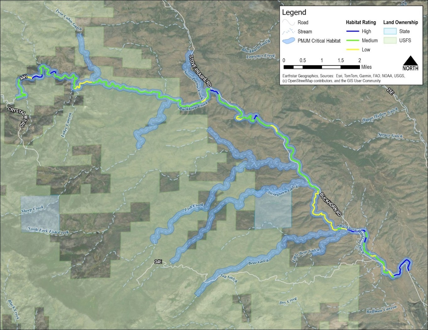
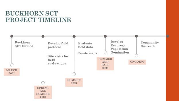
The SCT has already begun their work within the watershed. They have surveyed locations along Buckhorn Creek and ranked the quality of the habitat at those locations. The team also participated in the Rist Canyon Mountain Festival in 2025 and plan to participate again in 2026. In the future, we plan to engage with the community through neighborhood meetings and events, so keep your eyes open for announcements through social media, flyer postings in the community, and this website.
The SCT still needs to evaluate habitats along the tributary creeks that flow into Buckhorn Creek. If you live along those creeks and you are interested in collaborating with the SCT, please contact us and we can walk you through our survey process, which requires little time and effort.
Contact Us
For questions about the SCT and the work they are doing please contact us. We look forward to hearing from you!
Main Contacts:
Shelley Bayard de Volo, Buckhorn Creek SCT Chair, Larimer County Engineering, [email protected]
Marin Oschmann, Buckhorn Creek SCT Chair, Big Thompson Watershed Coalition, [email protected]